
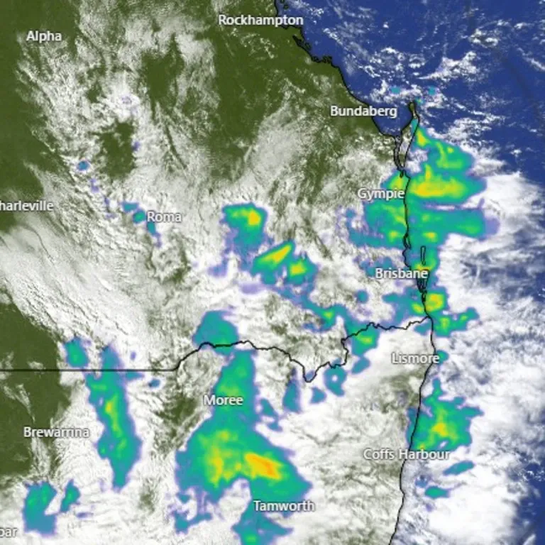
South East Queensland is entering a period of sustained rainfall and cooler temperatures, with the Bureau of Meteorology and private forecasters warning of a 72-hour deluge across the region.
A slow-moving weather system stretching more than 1,200km from Wide Bay in Queensland to central New South Wales is bringing widespread showers and possible thunderstorms. Early Wednesday morning, thick cloud and steady rain were reported across South East Queensland, particularly on the Sunshine Coast, where Parreara Weir on the Maroochy River recorded 74mm overnight, followed by Sugarbag Rd (69mm), Lake Cooroibah (62mm), and Tewantin (59mm). Cape Moreton and Tin Can Bay also recorded significant totals of 31.4mm and 25.6mm respectively.
Higgins Storm Chasing said a cold upper low over inland southern Queensland and northern NSW was “sucking like a hoover” and drawing in large amounts of moisture from the warmer-than-normal Coral Sea and Tasman Sea. “Even though August should be on the dry side, this combination will deliver widespread rainfall and some storms with hail across southern Queensland and the eastern half of NSW from now until late Friday,” they said.
Brisbane is expected to experience a milder but persistent rainfall event. Senior Bureau meteorologist Angus Hines said showers would move slowly into the city, bringing moderate amounts of rain rather than intense downpours. Rain gauges across Brisbane and much of South East Queensland could collect between 10mm and 40mm over Wednesday and Thursday. “A wet few days, cloudy few days, cool few days with dreary conditions,” he said.
The wet weather is also bringing cooler temperatures. Wednesday’s forecast high of 19 degrees is below the August average of 23.5 degrees, with the “feels-like” temperature expected to feel even lower. Thursday and Friday are forecast to reach a maximum of 22 degrees.
Further rainfall is expected across the wider region, with Brisbane potentially receiving up to 90mm, the Gold Coast up to 130mm, and the Sunshine Coast up to 75mm between Wednesday and Friday. Conditions are expected to gradually improve on Friday, with rainfall confined mostly to coastal areas early in the day.
Bureau meteorologist Helen Reid said the slow-moving system would continue to bring significant rainfall and possible thunderstorms through late week. “We’ve got more rain with thunderstorms as a possibility, particularly through the Gold Coast,” she said.